Written byDaniella Scalice
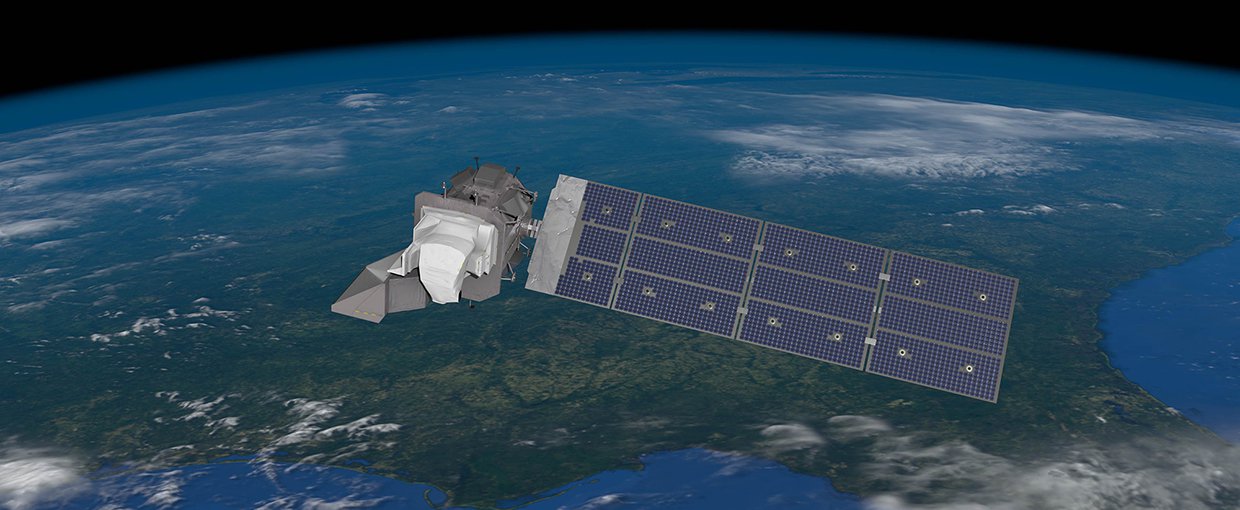
An artist's conception of the Landsat 9 spacecraft, the ninth satellite launched in the long-running Landsat program, high above the Western US.NASA
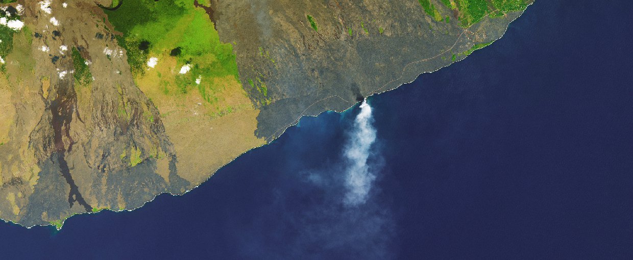
This 2017 image from Landsat 8 shows fiery explosions, large waves, and towering plume of steam and ash – the aftermath of unstable volcanic terrain tumbling into the sea, part of the Kilauea volcano on the Big Island of Hawai’i.Landsat 8 / NASA Earth Observatory / USGS
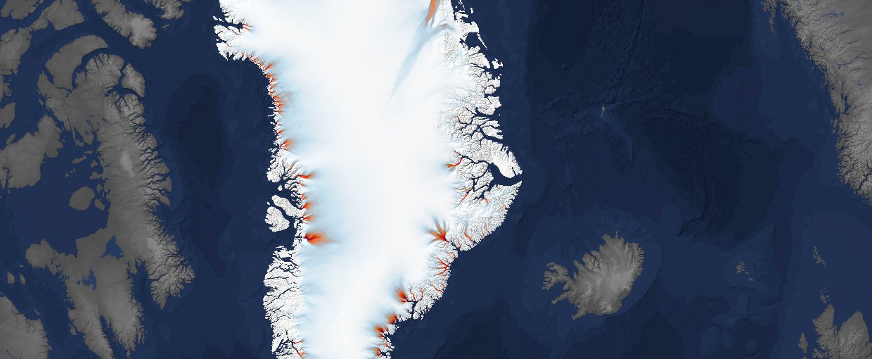
This is a composite of multiple Landsat images from 1985-2015, showing Greenland’s ocean-terminating glaciers and how some have not advanced and others have retreated.Landsat / USGS / ITS_LIVE at NASA/JPL-Caltech
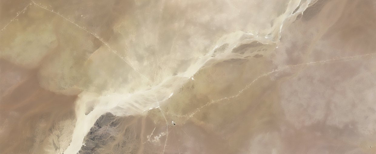
This image of a desert region in Oman was made in 1994 by Landsat 5 to assist archaeologists in their search for the “lost city” of Ubar.Landsat 5 / USGS
Thank you, Landsat, for 50 years of stunning images of our world! Since 1972, this partnership between NASA and the U.S. Geological Survey has continuously had satellites in orbit, looking back at Earth – and it continues with the Landsat 9 launch on Sept. 27.
Astrobiologists traverse the same landscapes that you’ve been showing us from space. We travel to these destinations for field work with instruments in our hands and questions about our origins in our minds.
Here are a few special places on Earth that we visit and what we’re learning there.
Go Landsat 9!
Oman
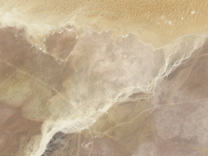
This image of a desert region in Oman was made in 1994 by Landsat 5 to assist archaeologists in their search for the “lost city” of Ubar.Image credit: Landsat 5 / USGS.
Astrobiologists have a history of working in Oman, studying landforms and rocks that represent ancient Earth, seeking to understand life’s origins. One team studied the Semail Ophiolite in the Hajar Mountains of Oman and the United Arab Emirates, which represents the largest exposed piece of oceanic crust in the world. One of the spaces thought by scientists to be where life first originated on Earth is in these interfaces between the ocean and the rocky mantle.
Greenland
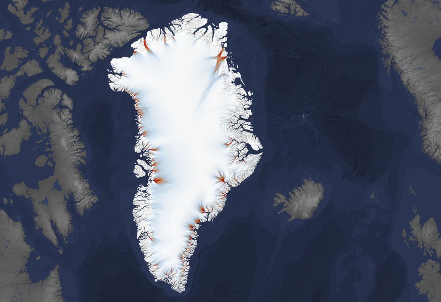
This is a composite of multiple Landsat images from 1985-2015, showing Greenland’s ocean-terminating glaciers and how some have not advanced and others have retreated.Image credit: Landsat / USGS / ITS_LIVE at NASA/JPL-Caltech.
Greenland is an important global location for astrobiology research. Recently, an instrument that could one day fly to Europa or Enceladus was successfully tested in Northwest Greenland over a subglacial lake. Called Seismometer to Investigate Ice and Ocean Structure (SIIOS), the instrument detected the ice-water interface, as well as normal seismic activity of the ice.
Hawai’i
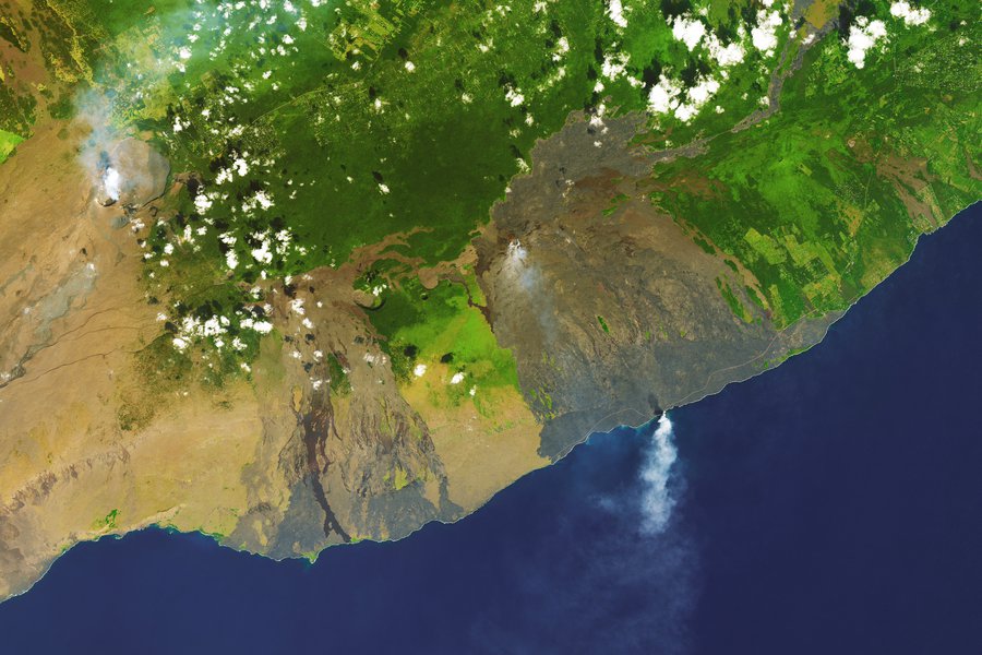
This 2017 image from Landsat 8 shows fiery explosions, large waves, and towering plume of steam and ash – the aftermath of unstable volcanic terrain tumbling into the sea, part of the Kilauea volcano on the Big Island of Hawai’i.Image credit: Landsat 8 / NASA Earth Observatory / USGS.
The “newest” island in the Hawai’ian chain is called Lo’ihi. Located about 22 miles off the southeast coast of the Big Island, it’s still underwater—still a seamount—about 3,200 feet below sea level. At it its current rate of production, it may not surface for another 200,000 years! But scientists are studying it, including astrobiologists who are testing a submersible vehicle equipped to study the lifeforms at Lo’ihi. They hope it will help them learn how to search and what to look for if one day such a vehicle could be sent to Saturn’s moon Enceladus, where similar underwater hydrothermal vents are thought to exist – and could be home to life beyond Earth.
For more information about Landsat, visit:
https://www.nasa.gov/landsat